North York Moors National Park Landscape Character Assessment Update

For North York Moors National Park Authority, 2021

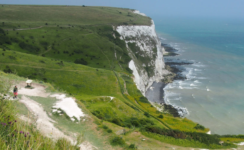
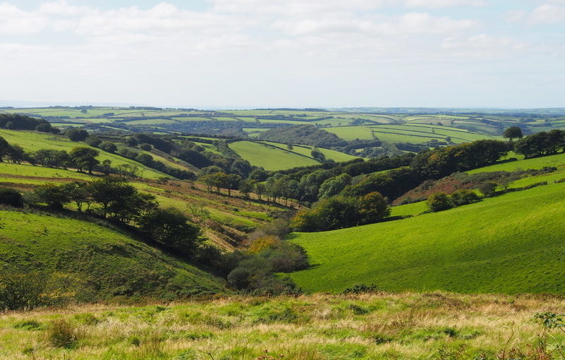
The North York Moors National Park contains an outstanding diversity of landscapes and seascapes. Its expansive heather moorland, spectacular coastline, intimate dales, picturesque settlements, rich woodlands, varied farmlands and magnificent views are very highly valued by residents and visitors.

We undertook a comprehensive review of the 2003 Landscape Character Assessment to bring it up to date and able to address today’s challenges. This included an emphasis on measures to pro-actively address the ongoing climate and biodiversity crises whilst enhancing landscape character. We incorporated current best-practice relating to Seascape Character Assessment, and identified new landscape Types and Areas along the coast. We integrated new concepts such as natural capital and ecosystem services into the Landscape Character Assessment, along with new information on remoteness, tranquillity and dark skies. The updated Landscape Character Assessment now provides comprehensive information on the natural, cultural and perceptual qualities of landscape within the National Park, and on the vital role played by its landscape and seascape setting.

Jersey Integrated Landscape and Seascape Character Assessment (ILSCA)

For Government of Jersey (2020)

Using Landscape and Seascape Character Assessment techniques to enable a holistic approach to sustainability across all terrestrial, intertidal and marine areas of the Bailiwick of Jersey.

As a small island nation, Jersey faces tremendous challenges in the face of global forces of climate change, biodiversity loss and development pressure. The ILSCA was commissioned as part of the evidence base for the New Island Plan, which aims to address these challenges through the promotion of sustainable development. The Bailiwick (jurisdiction) of Jersey includes an extra-ordinary diversity of marine and intertidal areas, as well as rich and distinctive landscape types within Jersey itself. All parts of the Bailiwick are being affected by global changes and pressures, and so the ILSCA holistically considers all environments – terrestrial, intertidal and marine. It provides a robust and consistent analysis across the entire study area, makes strong and practical recommendations for landscape/ seascape protection, enhancement and management, and celebrates Jersey’s unique landscapes and seascapes through photography, user-friendly language, and high-quality presentation.

In addition to the standard introduction, landscape / seascape ‘story’, and Character Type profiles, the ILSCA also contains two additional sections. The first is a new concept of ‘Coastal Units’. These are an additional layer of assessment, focussing on the most complex area (the coast) where many different Character Types and Character Areas meet and/or are inter-visible. The second is Landscape Design Guidance for rural and coastal areas, which provides guidance on accommodating new development, enhancing rural character, and consideration of views and visibility.

East Devon and AONBs Landscape Character Assessment and Management Guidelines

(ongoing)

This document provides a Landscape Character Assessment and Landscape Management Guidelines for East Devon District, East Devon AONB and the Blackdown Hills AONB. Parts of East Devon (specifically those areas which are not designated AONB) are currently facing unprecedented development pressure, and the vision and guidelines within this document will help to integrate that development into the landscape in the most positive way possible. These guidelines cover landscape management, the siting and design of development, and also identify potential opportunities for mitigation and landscape enhancement within the surrounding area.

The study area includes two AONBs, and the interfaces between the protected landscapes and the surrounding cities, towns and countryside.

Binevenagh and Coastal Lowlands Landscape Character Assessment

For Binevenagh and Coastal Lowlands Landscape Partnership (2018)

This project in Northern Ireland provides the landscape context for the HLF Landscape Partnership Scheme, identifying and defining six distinctive Landscape Character Areas, and describing them in detail using text, maps and photographs. The project area is largely within the Binevenagh AONB, and includes the eastern shore of Lough Foyle, the Binevenagh uplands, the historic estate of Downhill, the Binevenagh cliffs and parts of the River Bann valley. During the project Fiona undertook extensive fieldwork in the area, including site visits with the National Trust Ranger, and also stakeholder and community consultation sessions to inform the project outputs.

Fiona prepared a series of profiles (one for each Landscape Character Area) which present a description of the landscape, its key characteristics, natural, cultural and perceptual qualities, threats and forces for change, and project opportunities.

Kent Downs AONB Landscape Character Assessment Update

For Kent Downs AONB (Ongoing)

The previous Kent Downs Landscape Character Assessment was undertaken in 1995. Therefore an update was commissioned to inform the forthcoming revision of the AONB Management Plan. The updated Landscape Character Assessment takes into account current Landscape Character Assessment methodology, and has been subject to extensive stakeholder input and consultation.

The project has offered the opportunity to re-visit the photo locations from the 1995 Assessment, and to record the changes which have taken place in the landscape in the intervening 22 years. These include the re-growth of scarp-top woodland following the 1987 hurricane; the maturing of planting schemes associated with the Channel Tunnel Rail Link (HS1); the effects of Ash Dieback disease, and the planting of grapevines. The project also looks ahead and provides recommendations on landscape strategies for the future.

Exmoor National Park Landscape Character Assessment Update

With Countryscape, Alison Farmer Associates and Douglas Mitcham (2017)

Since the previous Exmoor Landscape Character Assessment was written in 2007, a great deal of new research has been undertaken on Exmoor, new concepts such as ecosystem services and natural capital have become mainstream, and the emphasis and presentation of landscape character assessments has developed. This major piece of work is an opportunity to integrate new information on archaeology, landscape history and moorland management, and to identify the natural capital and ecosystem services associated with various landscape types. The presentation has been updated to provide greater emphasis on perceptual and cultural qualities of the landscape, as well as its physical characteristics. This has involved extensive photography by Fiona, as well as sourcing a wide variety of images of Exmoor by past and contemporary artists. Importantly, the project provides an opportunity to look ahead and develop new visions and management strategies for the various landscape types, which will in turn protect and enhance Exmoor’s landscapes in the future. The document contains a new section on Planning Guidelines, and has been adopted as Supplementary Planning Guidance.

Ynys Cybi Landscape Partnership Landscape and Seascape Character Assessment

With Countryscape (2016)

The Tir & Môr Ynys Cybi Land& Sea Landscape Partnership is unusual in that its boundary contains terrestrial, inter-tidal and marine areas. The Landscape Character Assessment which supported the successful HLF Funding submission therefore needed to provide information on all these landscape and seascape types. Fiona achieved this by adapting and simplifying the relevant sections of the Anglesey and Snowdonia Seascape Character Assessment which she had completed a few years previously, to produce a document which provides a suitable basis for community use and Landscape Partnership decision-making. The document identifies nine distinctive landscape and seascape types within the study area, and describes their key characteristics, natural influences, cultural influences and perceptual qualities. Issues and forces for change affecting the landscapes are described, along with project opportunities under the themes of the Landscape Partnership. Community consultation was undertaken with local residents and stakeholders on how people describe the Ynys Cybi landscape, how it makes them feel, and their concerns about issues affecting the landscape.

Romney Marsh Landscape Character Assessment

(2016)

This Landscape Character Assessment was commissioned jointly by Kent Wildlife Trust (on behalf of the Fifth Continent Landscape Partnership) and Shepway District Council. It is intended to inform both the Fifth Continent Landscape Conservation Action Plan and Shepway District Council’s forthcoming Places and Policies Local Plan. Romney Marsh is a unique landscape with a very strong sense of place. The character of the landscape today varies subtly across Romney Marsh, reflecting several centuries of land reclamation and coastal processes. These variations (and the history behind them) are identified and described in the Landscape Character Assessment. The study area also includes the distinctive shingle landscape of Dungeness, which is internationally-designated for its shingle habitats and the species they support, as well as being a popular destination for visitors.

Following-on from the Romney Marsh Landscape Assessment, a separate study was undertaken as a pilot for a new approach to landscape character assessment which is being discussed within Kent. In this approach, the focus is on the features of the landscape that need to be conserved in order to retain the character of the landscape. The intention is that by showing how character is defined by patterns of features, the process will help to make informed decisions about the impacts of change and development on landscape character. The four landscape elements chosen for the pilot study were watercourses, rural lanes, shingle and parish churches.

Landscape Connections and Perceptions — A Cornish Pilot Study

Fiona Fyfe Associates with Plymouth University (2015)

This European Social Fund project is being undertaken with Plymouth University. It is a research-based pilot project based in four contrasting landscapes around Cornwall. The aims of the project are:

  • To ascertain differences in how rural landscapes are perceived within the rural landscapes themselves and in neighbouring towns.
  • To understand the barriers which prevent residents accessing local landscapes.
  • To make recommendations on how these barriers can be overcome to create positive social and health benefits.
  • To investigate differences in people’s perceptions of different landscape types.
  • To find the locations of people’s favourite views, and why they are popular.

Devon Advice Note on using Landscape Character Assessment in Neighbourhood Plans

For Devon County Council (2015)

This document is aimed at members of the public who do not currently have technical knowledge of the landscape assessment process, but wish to use existing Landscape Character Assessments in the production of Neighbourhood Plans. It introduces the concept of landscape character assessment, and demonstrates how local communities can use Landscape Character Assessments to enhance their local environment, and to positively shape the places where they live.

The Advice Note has been adapted for use by Cranborne Chase AONB, and also by the CPRE in their nationally-applicable publication What’s Special to you: Landscape Issues in your Neighbourhood Plans, July 2017. The Devon Advice Note was Commended in the SW RTPI Awards for Planning Excellence 2017.


Extract from Advice Note 4. 
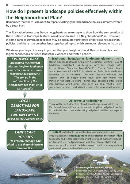
Extract from Advice Note 4.[/caption