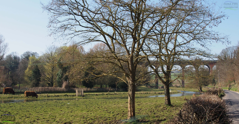
The Darent Valley Landscape Partnership Scheme (LPS) area follows the river Darent from its source springs in the Weald to its confluence with the river Thames near Dartford. This project required the production of a single Landscape Character Assessment for the LPS area, and the identification of a series of Landscape Character Areas which reflect the changing stages of the river and its surroundings. 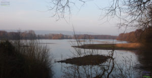 The Plan contains a vision for each Landscape Character Area, and a series of practical project proposals and opportunities to make that vision a reality. The Plan was part of a successful First Round bid for Heritage Lottery Funding under the Landscape Partnership Scheme.
Category: Protected Landscapes
Strategic Landscape Enhancement Plan for the Darent Valley, Kent
Anglesey and Snowdonia Seascape Character AssessmentWith Countryscape and SEACAMS/ Bangor University (2013)
This project was undertaken for Anglesey Coast AONB, Snowdonia National Park and Natural Resources Wales. The study area included the coast of Anglesey, and the coast of mainland Wales from the Great Orme to the Dyfi Estuary (excluding the Lleyn Peninsula). The project was an extension of the conventional landscape character assessment process. It involved the identification and mapping of marine, intertidal and terrestrial Seascape Character Types (SCTs), and the grouping of these into geographically-distinct Seascape Character Areas (SCAs). Maps and profiles were prepared for all the SCTs and SCAs. SCT profiles describe each SCT and where it occurs. SCA profiles provide an in-depth study of each SCA, including its key characteristics, natural influences and sites, cultural influences and sites, perceptual qualities, and the cultural ecosystem services which it provides. The forces for change associated with each SCA are described, along with inherent sensitivity.
Because the majority of SCAs include a combination of marine, intertidal and terrestrial SCTs, the project provides a comprehensive overview of the physical and cultural relationships between land and sea, and how these have developed over time. The report is being use d in a variety of ways, including contributions to planning decisions (for onshore and offshore development proposals), the management of coastal conservation and cultural sites, and shoreline management.
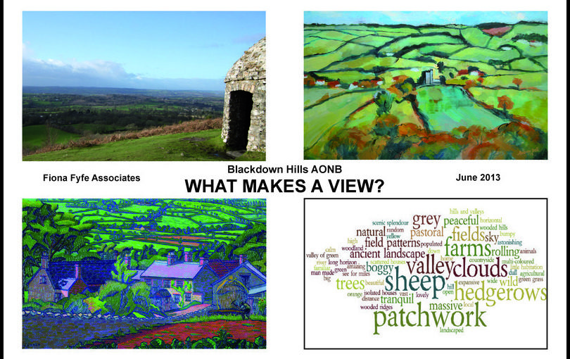
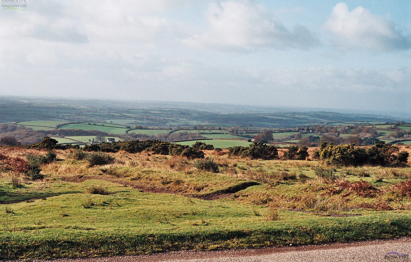
“What Makes a View ?” The Blackdown Hills AONBWith Sological Solutions and Robin Lines Landscape (2013)

This project is simultaneously an analysis and a celebration of the Blackdown Hills AONB landscape and views. It was funded through the European CORDIALE project under the Interreg IV A programme, and has three key elements:
- A report describing the views within the Blackdown Hills AONB: Where they occur; how they are experienced; how they are portrayed; how they relate to landscape character, and the forces for change currently acting on them.
- A planning and management tool to be used to retain and enhance the area’s views in the future.
- A framework for enabling members of the local community to monitor long-term incremental landscape changes.
The local community was involved in many aspects of the project, including submitting their favourite views through online public consultation, completing questionnaires at AONB events and community centres, taking part in special projects in local schools, and contributing to the AONB’s landscape photography competition. Several local artists have also been involved, and their work illustrates the final report.
Brecon Beacons National Park Landscape Character Assessment and Supplementary Planning GuidanceWith Countryscape, Alison Farmer Associates and Julie Martin Associates (2012)
This major project was led and project managed by Fiona Fyfe. Fiona was involved in all stages of the project, including fieldwork, photography, stakeholder workshops and writing of the final report. The landscape character assessment was carried out using the recognised best-practice methodology for landscape character assessment, and also incorporated the Welsh LANDMAP GIS resource. The project brought together a large amount of data and background information on the National Park’s geology, ecology, archaeology, designations, landscape history, population, settlement and development issues. It presents this information in an attractive and easily readable way using text, maps, illustrations and photographs. The Landscape Character Assessment includes a brief ‘story of the Brecon Beacons landscape’, and a summary of the forces for change currently acting on the area’s landscape. It identifies fifteen distinctive Landscape Character Areas within the National Park, and sets out their distinctive characteristics, special qualities, sensitivities, landscape history, key views, Green Infrastructure and ecosystem services. It also looks at the forces for change acting on each Landscape Character Area, and makes recommendations for their future management in order to retain and enhance their special qualities.
The accompanying Supplementary Planning Guidance provides recommendations on how the planning system can be used to enhance landscape character. As well as text, this document also uses ‘before and after’ sketches and flowcharts to illustrate how consideration of landscape character can be positively applied to development proposals.
Management Plan for Hillsborough Prehistoric Fort, IlfracombeWith University of Leicester Archaeological Service (2011)
This project was undertaken for the North Devon Coast AONB and North Devon Council. Hillsborough is an elevated headland to the east of Ilfracombe in North Devon. The site is of considerable importance for its archaeology and wildlife, and its recreation and landscape values. It is covered by numerous designations, and is a Scheduled Monument. The five-year Management Plan brings together the various requirements of the site and provides a focus for community involvement.
It also made recommendations regarding the future interpretation of the site, including projects which could form future grant funding applications.
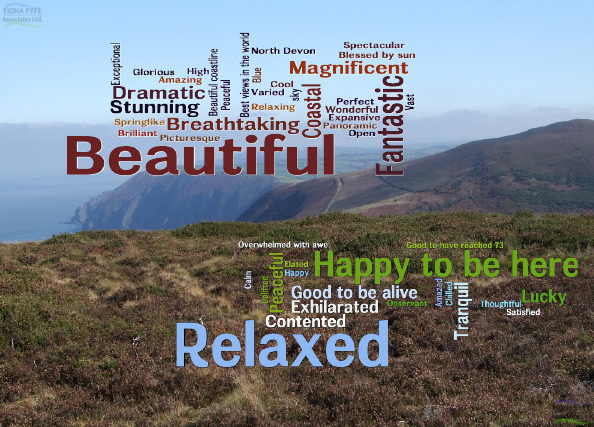
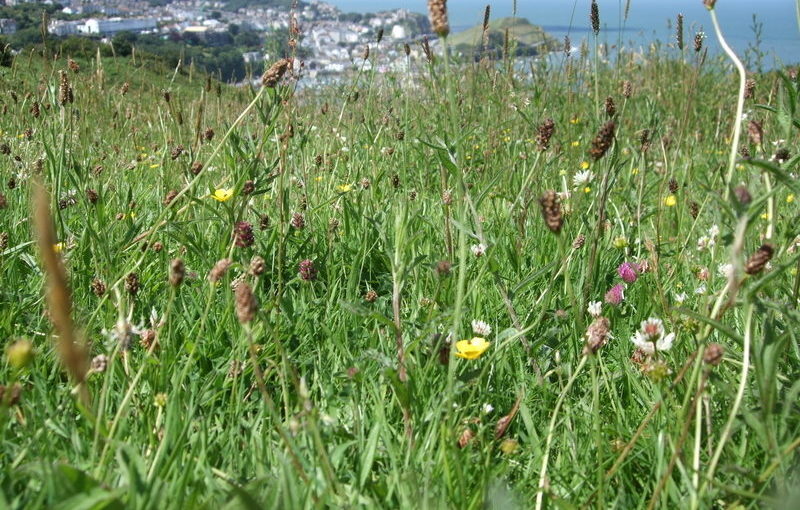
Exmoor Landscape Perceptions Study(2011)
This project, commissioned by Exmoor National Park Authority and the Exmoor Society, took place over the course of a year, and examined how members of the public perceive each of the nine different landscape types within the National Park. Data was recorded and analysed on how the public describe each of the landscape types, how they feel when they are there, the ways in which they value the landscape, and their observations of positive and negative changes in the landscape. The management recommendations at the end of the study are currently informing the review of the Exmoor National Park Management Plan. The project features as a case study in the Landscape Institute position statement on Landscape and Public Health (2013).
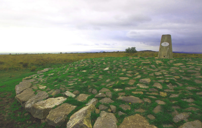
Archaeological Management Plan for Black Down and Burrington Combe, Mendip Hills AONBWith University of Leicester Archaeological Services (2010)
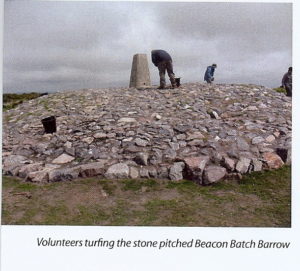
The project area included an extensive Scheduled Monument containing archaeological features dating from the Bronze Age to the Second World War. The majority of the area is also designated SSSI and is managed under Higher Level Stewardship (HLS). High levels of recreation and changing land cover (particularly increased bracken) were causing extensive damage to archaeological features, so it was necessary to find an acceptable balance between archaeological, recreation and conservation interests.
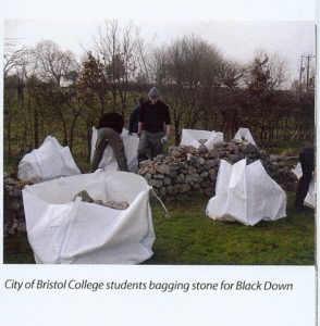
A condition assessment of the archaeology was undertaken by ULAS and a number of management recommendations were made. Some of these recommendations (such as stone-pitching the eroded ground around a trig point, thereby protecting the underlying Bronze-Age barrow from further damage) have already been carried out as special projects under HLS with involvement from local community volunteers. Bracken clearance of the most sensitive features is also being carried out under HLS. Other recommendations, such as the provision of interpretation panels and the re-routing of footpaths have been incorporated into a successful Heritage Lottery Fund bid.
Landscape Sensitivity Study for land to the South of Exmoor National Park(2009)
This project examined the sensitivity of the landscape within the setting of Exmoor National Park with regard to large scale wind turbine development. It is a particularly rich historic landscape, containing relict areas of unenclosed common land, historic field systems, and numerous ancient features and settlements. Fiona used the study as part of her evidence as a Landscape witness at Public Inquiry, objecting to proposed windfarm developments in this area. Following the Public Inquiry, the Inspector rejected the appeal on the grounds of the impact on the setting of Exmoor National Park.