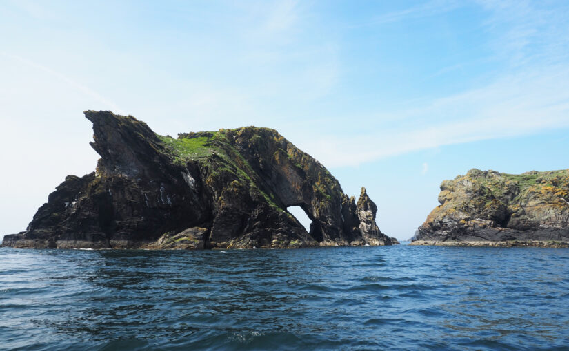
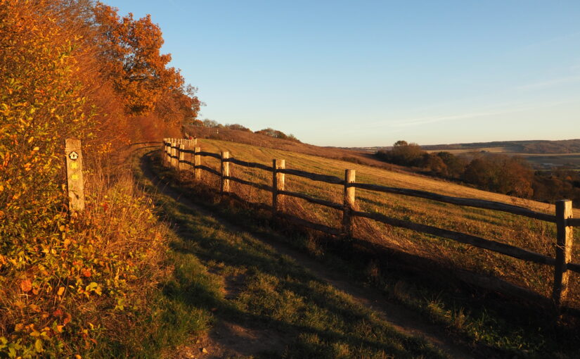
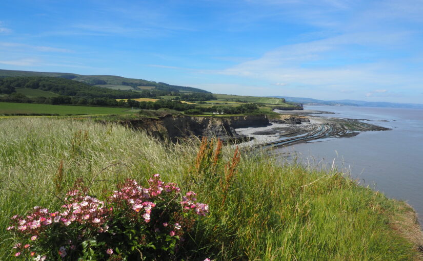
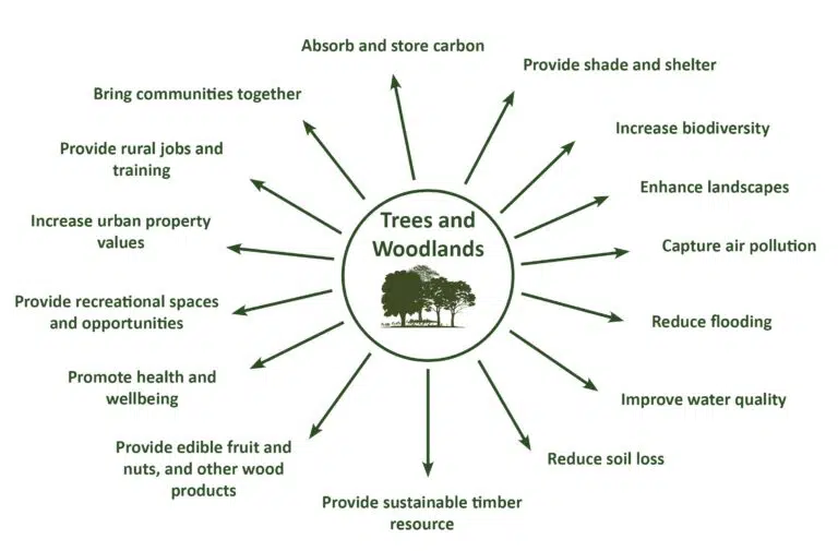
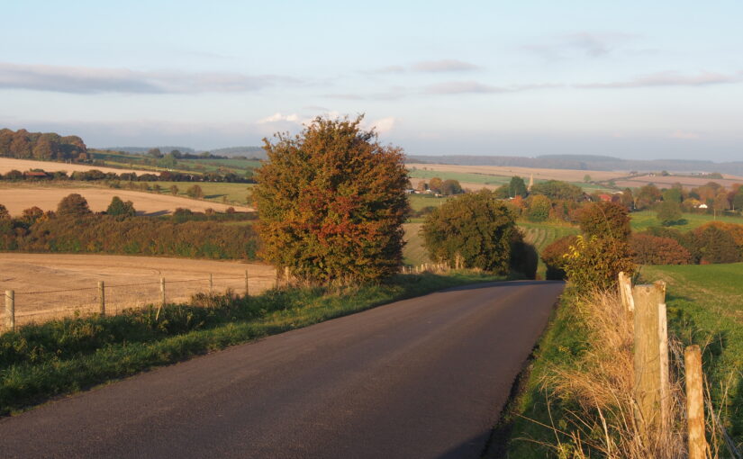
Jersey Landscape Sensitivity Assessment

For Government of Jersey, 2020

Landscape Sensitivity is a measure of the resilience of a landscape to withstand change arising from development without undue negative effects on the landscape or views.

The methodology for the Jersey Landscape Sensitivity Assessment was in line with the current best practice on landscape sensitivity assessment and also takes into account the particular circumstances, and the landscape and seascape context, of Jersey. The outputs of the Assessment were used by the Government of Jersey to help identify the most appropriate sites for new housing in the Island Plan Review. A list of study areas was provided by the client, including key villages and parts of the island’s urban fringes.

The project used a two-stage methodology. The first stage was a desk-based assessment (confirmed in the field) to identify Local Landscape Units (LLUs) within each study area, primarily based on landscape character. Those LLUs which exhibited sensitive special qualities identified in the Landscape Character Assessment, or which had other heritage or nature conservation sensitivities, were not assessed further.

The LLUs which were considered to have some potential to accommodate residential development without significant adverse landscape or visual impacts were assessed in more detail. For these LLUs, field-based analysis was undertaken, and tabulated sensitivity ratings provided on a 5-point scale from low to high. Recommendations for mitigation and enhancement measures were also provided for each study area, reflecting local landscape and settlement character.

North York Moors National Park Landscape Character Assessment Update

For North York Moors National Park Authority, 2021

The North York Moors National Park contains an outstanding diversity of landscapes and seascapes. Its expansive heather moorland, spectacular coastline, intimate dales, picturesque settlements, rich woodlands, varied farmlands and magnificent views are very highly valued by residents and visitors.

We undertook a comprehensive review of the 2003 Landscape Character Assessment to bring it up to date and able to address today’s challenges. This included an emphasis on measures to pro-actively address the ongoing climate and biodiversity crises whilst enhancing landscape character. We incorporated current best-practice relating to Seascape Character Assessment, and identified new landscape Types and Areas along the coast. We integrated new concepts such as natural capital and ecosystem services into the Landscape Character Assessment, along with new information on remoteness, tranquillity and dark skies. The updated Landscape Character Assessment now provides comprehensive information on the natural, cultural and perceptual qualities of landscape within the National Park, and on the vital role played by its landscape and seascape setting.

North York Moors Settlement Sensitivity Studies

For North York Moors National Park Authority, 2021

This project was undertaken in conjunction with the North York Moors Landscape Character Assessment Update. Its purpose was to identify the key sensitivities associated with each of the 16 ‘Larger Villages’ within the National Park, plus the town of Helmsley. It is in these places where small-scale development (such as affordable housing schemes) is most likely to be located.

A settlement’s character and ‘sense of place’ can be eroded by development which does not respect its form, landscape setting, distinctive features or views. Therefore by identifying and protecting the sensitive features of each settlement, future development can be incorporated in a way which does not damage the settlement’s unique character or sense of place, and will also be sensitive to the landscape in which the settlement is situated.

The settlements studied include towns and villages with coastal, farmland, moorland, historic parkland and woodland settings. Desk studies and fieldwork were undertaken to understand settlements’ landscape context, form, character, approaches and gateways, edges, and visual relationship with their surrounding landscape.

Right Tree Right Place: A Landscape Approach

Fiona Fyfe Associates with Dominica Williamson for Devon County Council

This ongoing project provides guidance for those wishing to plant trees in Devon. Devon County Council is keen to meet sustainability targets and enhance biodiversity through tree planting, but also needs to ensure that the newly-planted trees respect and enhance landscape character, and are not detrimental to existing ecological and heritage assets. This publication takes key messages relating to tree planting and landscape character from a wide variety of sources, including the Forestry Commission, Woodland Trust, Devon Environment Viewer and the Devon-wide Landscape Character Assessment. It provides guidance to ensure that the right tree is planted in the right place, and that local variations in landscape character are sustained and enhanced through appropriate tree planting.

Summary of Trees and Woodland benifits

Jersey Coastal National Park Boundary Review

Fiona Fyfe Associates with Karin Taylor and Countryscape for Government of Jersey (2020)

This innovative project helps the Government of Jersey achieve its ambition for a unique National Park which extends both inland and out to sea, encompassing terrestrial, intertidal and marine areas.

A project-specific methodology was developed based on the existing Natural England methodology for designating Protected Landscapes, but tailored for application in Jersey’s unique island environment. The criteria for inclusion within the Jersey Coastal National Park work equally well for land and marine areas.

In addition to extending the National Park offshore, the recommended Coastal National Park boundary also aims to ensure that the coastline and its inland and seaward setting are appropriately protected, and provides a clear, consistent and unambiguous boundary for the National Park. It also reflects the updated landscape and seascape typology provided in the Jersey Integrated Landscape and Seascape Character Assessment (Fiona Fyfe Associates 2020).

Kent Downs AONB Landscape Design Handbook Update

Fiona Fyfe Associates with Untitled Practice for Kent Downs AONB (2019)

This handbook provides practical advice and inspiration to promote landscape-sensitive design within the Kent Downs Area of Outstanding Natural Beauty (AONB). Given the designation of the area as AONB, it is vital that the characteristics of the Kent Downs landscape are understood, protected and enhanced in order that the evolving landscape retains its special character. The Landscape Design Handbook aims to ensure that any new development, land use or land management approach respects and enhances the Kent Downs’ unique sense of place. It sets out design principles and detailed design recommendations to promote good practice in landscape design across the AONB, to enhance the distinctive features of the landscape and to promote local variation in landscape character.

The updating of the Landscape Design Handbook is very timely given the unprecedented pressure for development both within the AONB and within its setting. Some of the pressure is from large-scale development, but small-scale development and change can also be damaging to local character unless it is undertaken sensitively. The Handbook addresses one-off and cumulative landscape changes, and is relevant to both development planning and landscape management projects.

Jersey Integrated Landscape and Seascape Character Assessment (ILSCA)

For Government of Jersey (2020)

Using Landscape and Seascape Character Assessment techniques to enable a holistic approach to sustainability across all terrestrial, intertidal and marine areas of the Bailiwick of Jersey.

As a small island nation, Jersey faces tremendous challenges in the face of global forces of climate change, biodiversity loss and development pressure. The ILSCA was commissioned as part of the evidence base for the New Island Plan, which aims to address these challenges through the promotion of sustainable development. The Bailiwick (jurisdiction) of Jersey includes an extra-ordinary diversity of marine and intertidal areas, as well as rich and distinctive landscape types within Jersey itself. All parts of the Bailiwick are being affected by global changes and pressures, and so the ILSCA holistically considers all environments – terrestrial, intertidal and marine. It provides a robust and consistent analysis across the entire study area, makes strong and practical recommendations for landscape/ seascape protection, enhancement and management, and celebrates Jersey’s unique landscapes and seascapes through photography, user-friendly language, and high-quality presentation.

In addition to the standard introduction, landscape / seascape ‘story’, and Character Type profiles, the ILSCA also contains two additional sections. The first is a new concept of ‘Coastal Units’. These are an additional layer of assessment, focussing on the most complex area (the coast) where many different Character Types and Character Areas meet and/or are inter-visible. The second is Landscape Design Guidance for rural and coastal areas, which provides guidance on accommodating new development, enhancing rural character, and consideration of views and visibility.

Tyne-Tees Coast Historical and Archaeological Review

For Tyne-Tees Shores and Seas Landscape Partnership (2019)

This unique project was commissioned by the Tyne-Tees Shores and Seas SeaScape Partnership, to inform their successful application to the National Lottery Heritage Fund under the Landscape Partnership Scheme (LPS). This is the first sea-based Landscape Partnership, and the study area includes the coastline and extends for 8km out to sea. The aims of the LPS are to re-establish connections between the local communities and the coast and sea. Although the area is well known for its coastal collieries, one of the objectives of the LPS is to raise awareness of other elements of the area’s fascinating history which are often overlooked.

The SeaScapes Area encapsulates people’s changing relationships with the sea over millennia. During this time the coast and sea have been a source of food and resources; a conduit for travel and trade; a place of skill in boatbuilding and seamanship; a place of danger, tragedy, and brave rescues; a stimulus for scientific and engineering innovation; the backdrop for recreation and pleasure; a scene of war and defence, and place of cultural inspiration.

This project required a large amount of data search (including Historic Environment Records, archives, books, historic maps and charts, galleries, museums, academic publications, marine surveys and fieldwork) then the presentation of key relevant information in an accessible and engaging way through a series of illustrated profiles. The profiles are broadly chronological. They begin with evidence from the end of the last Ice Age, when the North Sea was dry land, and continue through prehistoric, Roman and Saxon seaways, Medieval ports, shipbuilding, harbours, shipping routes, whaling boats, fishing, navigation, lifesaving, recreation and defence, right through to post-coal energy generation. Together, they describe the complex interrelationships which have evolved between coastal communities and the sea, and hopefully inspire today’s communities to find out more.

East Devon and AONBs Landscape Character Assessment and Management Guidelines

(ongoing)

This document provides a Landscape Character Assessment and Landscape Management Guidelines for East Devon District, East Devon AONB and the Blackdown Hills AONB. Parts of East Devon (specifically those areas which are not designated AONB) are currently facing unprecedented development pressure, and the vision and guidelines within this document will help to integrate that development into the landscape in the most positive way possible. These guidelines cover landscape management, the siting and design of development, and also identify potential opportunities for mitigation and landscape enhancement within the surrounding area.

The study area includes two AONBs, and the interfaces between the protected landscapes and the surrounding cities, towns and countryside.

Binevenagh and Coastal Lowlands Landscape Character Assessment

For Binevenagh and Coastal Lowlands Landscape Partnership (2018)

This project in Northern Ireland provides the landscape context for the HLF Landscape Partnership Scheme, identifying and defining six distinctive Landscape Character Areas, and describing them in detail using text, maps and photographs. The project area is largely within the Binevenagh AONB, and includes the eastern shore of Lough Foyle, the Binevenagh uplands, the historic estate of Downhill, the Binevenagh cliffs and parts of the River Bann valley. During the project Fiona undertook extensive fieldwork in the area, including site visits with the National Trust Ranger, and also stakeholder and community consultation sessions to inform the project outputs.

Fiona prepared a series of profiles (one for each Landscape Character Area) which present a description of the landscape, its key characteristics, natural, cultural and perceptual qualities, threats and forces for change, and project opportunities.