Bath Views and Vistas Project

For Bathscape Landscape Partnership (2017)

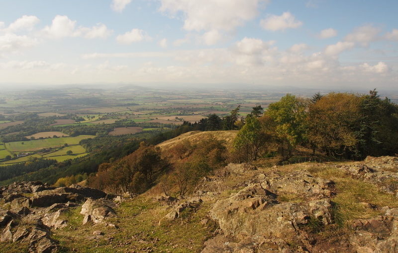
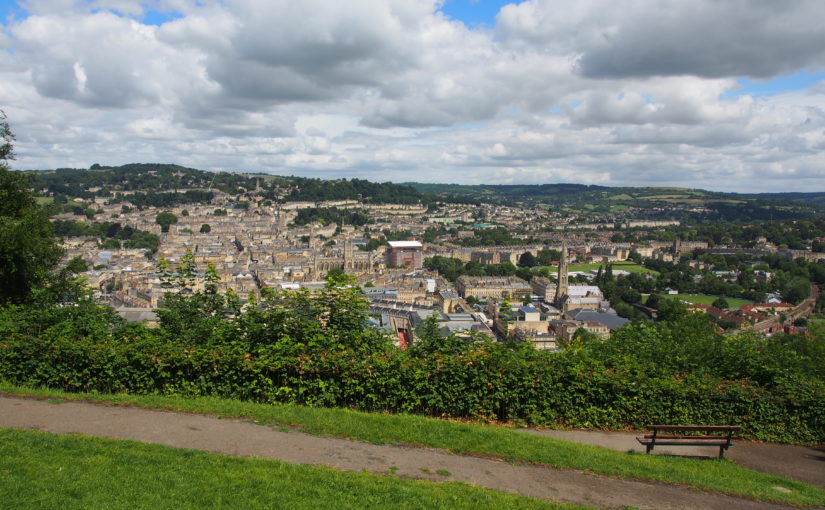
The city of Bath is designated a UNESCO World Heritage Site, in part because of its green setting in a hollow of the hills. The landscape setting of Bath is very important, but is nevertheless threatened by a range of factors including vegetation growth, skyline developments and changes in the balance of woodland and open land.

The Bath Views and Vistas Project is one of a suite of projects which will inform the Second Round LHF Submission for the Bathscape Landscape Partnership. It identifies and analyses a representative selection of views and vistas within Bath and its setting, and makes recommendations for the protection, management and planning of each one so that they can be retained and enhanced in the future. The project also contains a toolkit to enable local volunteers to repeat the process for other viewpoints at a later stage of the Bathscape project.

Exmoor National Park Landscape Character Assessment Update

With Countryscape, Alison Farmer Associates and Douglas Mitcham (2017)

Since the previous Exmoor Landscape Character Assessment was written in 2007, a great deal of new research has been undertaken on Exmoor, new concepts such as ecosystem services and natural capital have become mainstream, and the emphasis and presentation of landscape character assessments has developed. This major piece of work is an opportunity to integrate new information on archaeology, landscape history and moorland management, and to identify the natural capital and ecosystem services associated with various landscape types. The presentation has been updated to provide greater emphasis on perceptual and cultural qualities of the landscape, as well as its physical characteristics. This has involved extensive photography by Fiona, as well as sourcing a wide variety of images of Exmoor by past and contemporary artists. Importantly, the project provides an opportunity to look ahead and develop new visions and management strategies for the various landscape types, which will in turn protect and enhance Exmoor’s landscapes in the future. The document contains a new section on Planning Guidelines, and has been adopted as Supplementary Planning Guidance.

The Aberdeen Landscape Study

With Douglas Harman Landscape Planning, Carol Anderson Landscape Associates, Buchan Landscape Architecture and Countryscape (Ongoing)

Fiona is providing specialist input on landscape archaeology and cultural heritage to the team led by Douglas Harman Landscape Planning. Her research focusses on both designated and non-designated sites and landscapes within the study area, and enables them to be recognised when planning for the future. The Aberdeen Landscape Study comprises a suite of complementary documents, including a Coastal Character Assessment; revised and updated Landscape Character Assessment; Peri-urban Study, and Landscape Sensitivity Study.

Blackdown Hills Landscape Enhancement Initiative

For Blackdown Hills AONB (2017)

This project was commissioned through the National Grid Landscape Enhancement Initiative (LEI) scheme, open to protected landscapes which are affected by high voltage power lines. It identified a number of landscape enhancement opportunities within the Blackdown Hills AONB which fulfil the LEI criteria, including strengthening historic landscape patterns of hedgerows; enhancing the settings of settlements and listed buildings; opportunities for habitat creation and enhancement, and improvements to public access.

Ynys Cybi Landscape Partnership Landscape and Seascape Character Assessment

With Countryscape (2016)

The Tir & Môr Ynys Cybi Land& Sea Landscape Partnership is unusual in that its boundary contains terrestrial, inter-tidal and marine areas. The Landscape Character Assessment which supported the successful HLF Funding submission therefore needed to provide information on all these landscape and seascape types. Fiona achieved this by adapting and simplifying the relevant sections of the Anglesey and Snowdonia Seascape Character Assessment which she had completed a few years previously, to produce a document which provides a suitable basis for community use and Landscape Partnership decision-making. The document identifies nine distinctive landscape and seascape types within the study area, and describes their key characteristics, natural influences, cultural influences and perceptual qualities. Issues and forces for change affecting the landscapes are described, along with project opportunities under the themes of the Landscape Partnership. Community consultation was undertaken with local residents and stakeholders on how people describe the Ynys Cybi landscape, how it makes them feel, and their concerns about issues affecting the landscape.

Northampton Green Infrastructure Plan

With Countryscape and the University of Northampton (2016)

This document provides a framework for the practical implementation of Green Infrastructure through the planning process. It is intended for use by planners, developers, project managers, community groups and other organisations. It puts strategic thinking on Green Infrastructure into practise at the local level, and enables the Local Authority to act on their obligations with regard to creation and enhancement of GI as set out in European, National and Local planning policy.

The Green Infrastructure Plan divides Northampton’s Local Level Green Infrastructure Network into a series of Components. These Components are either based on geographical location or on the type of Green Infrastructure which they represent. By splitting the Local Level Green Infrastructure Network into its components, it is possible to understand how the Network functions at a local level, and what needs to be done to enhance it. A series of profiles put each of the Components into their Green Infrastructure context, and describe their existing and potential functions in terms of biodiversity, connectivity and access, community and public health, landscape, heritage, flooding and water management and ecosystem services. The Green Infrastructure Plan is also integrated with the Northampton Interactive Map.

Romney Marsh Landscape Character Assessment

(2016)

This Landscape Character Assessment was commissioned jointly by Kent Wildlife Trust (on behalf of the Fifth Continent Landscape Partnership) and Shepway District Council. It is intended to inform both the Fifth Continent Landscape Conservation Action Plan and Shepway District Council’s forthcoming Places and Policies Local Plan. Romney Marsh is a unique landscape with a very strong sense of place. The character of the landscape today varies subtly across Romney Marsh, reflecting several centuries of land reclamation and coastal processes. These variations (and the history behind them) are identified and described in the Landscape Character Assessment. The study area also includes the distinctive shingle landscape of Dungeness, which is internationally-designated for its shingle habitats and the species they support, as well as being a popular destination for visitors.

Following-on from the Romney Marsh Landscape Assessment, a separate study was undertaken as a pilot for a new approach to landscape character assessment which is being discussed within Kent. In this approach, the focus is on the features of the landscape that need to be conserved in order to retain the character of the landscape. The intention is that by showing how character is defined by patterns of features, the process will help to make informed decisions about the impacts of change and development on landscape character. The four landscape elements chosen for the pilot study were watercourses, rural lanes, shingle and parish churches.

Historic Environment Characterisation for Secrets of the Sands: The Greensand Country Landscape Partnership

With Albion Archaeology and Alison Farmer Associates (2016)

Working as sub-consultants to Alison Farmer Associates, Albion Archaeology and Fiona Fyfe Associates produced a Historic Environment Characterisation for this Landscape Partnership, which focusses on the Greensand Ridge running from Cambridgeshire, through Bedfordshire and into Buckinghamshire. The Historic Environment Assessment uses a range of archaeological, built form and historic environment information, plus field work, to identify a series of distinct Historic Environment Character Zones. For each Zone, summary information is provided on its archaeology, landscape history, extant features, built environment and field patterns. A condition assessment is also provided. The report will be used by the Landscape Partnership in a variety of ways, including the identification of projects to take forward into the Landscape Conservation Action Plan.

Telford and Wrekin Strategic Landscapes Study

With Douglas Harman Landscape Planning and Countryscape (2015)

This project forms part of the evidence base for the forthcoming Telford & Wrekin Local Plan. It identifies three landscapes which are of distinctive character and special quality, and provides information about their key characteristics and sensitivities. Planning and management principles are provided to help ensure that these special qualities are retained and enhanced in the future. The Strategic Landscape Areas will be a useful tool for Telford & Wrekin Council in their ongoing work to protect and enhance these particularly special and valued landscapes.

Medway Green Infrastructure Planning Project

With Countryscape (2015)

This project was commissioned by Medway Council, and is a technical study to inform the forthcoming Medway Local Plan. It provides a strategic vision for Medway’s Green Infrastructure, and will also inform the choice of sites allocated for development. It will be taken forward by Medway Council to discuss local issues and opportunities to address in the emerging Local Plan. The report introduces the concept of Green Infrastructure, and the range of Green Infrastructure assets present within Medway. It identifies issues and opportunities to be addressed through Green Infrastructure, covering the themes of landscape, biodiversity assets, open spaces, movement networks, and social and public health issues. A strategic vision for Medway’s Green Infrastructure is presented, along with potential delivery mechanisms to achieve it. More detail on Green Infrastructure assets and opportunities is provided for five focus areas which are experiencing particularly acute development pressure.